Work and classes chill until 26 September because of Typhoon Harding.
This year the typhoon season is impacting North America too hence the cries for massive relief effort in the Philippines goes nearly unheard. Still Typhoon Harding has slashed its might with 275 km/hr winds in a swath across middle Luzon Island impacting dozens of millions of people.
President Ferdinand Marcos shared a short video clip of himself inside a chopper on his official Twitter account and announced in a press briefing at the National Disaster Risk Reduction and Management Council (NDRRMC) headquarters in Quezon City his plan to conduct an aerial inspection.
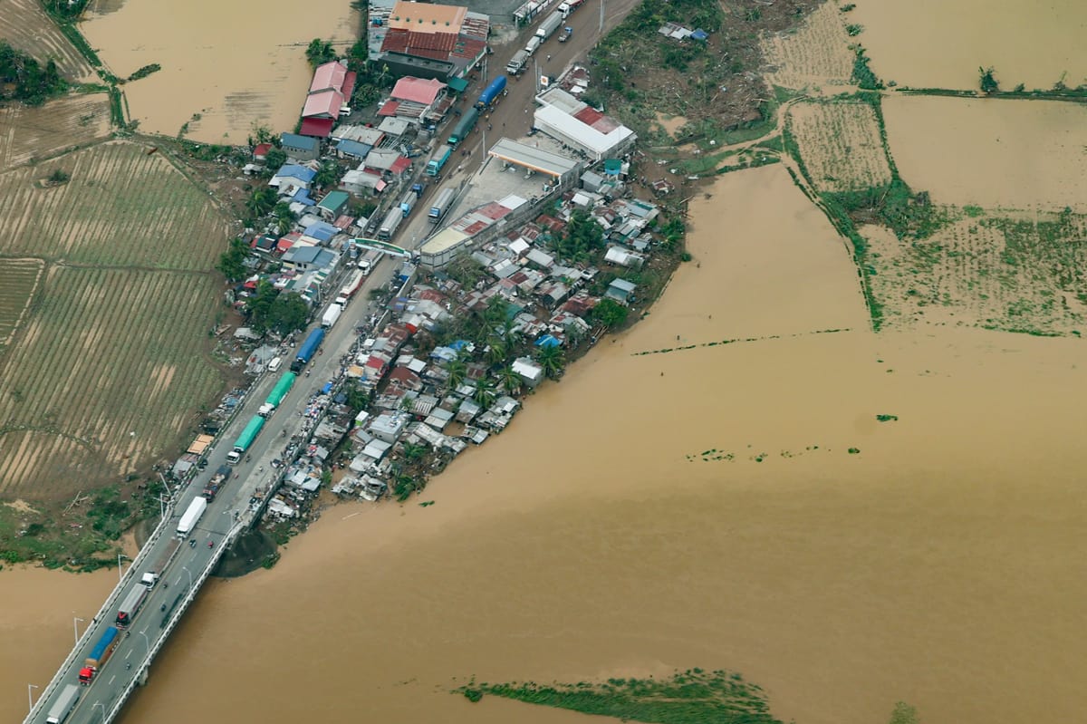
Typhoon Karding Updates from RINJ Women in the Philippines. Malacañang photo. Marcos says that “generally, the damage to public and private infrastructure is manageable. Government services are almost at full function.”
Typhoon Karding Updates from RINJ Women in the Philippines. Malacañang photo. “After our aerial inspection today,” Marcos said, “we found some areas that are still inundated with water.”
 Malacañang aerial photo.
Most “Main Road thoroughfares are passable; communication is up and running ,” said Marcos.
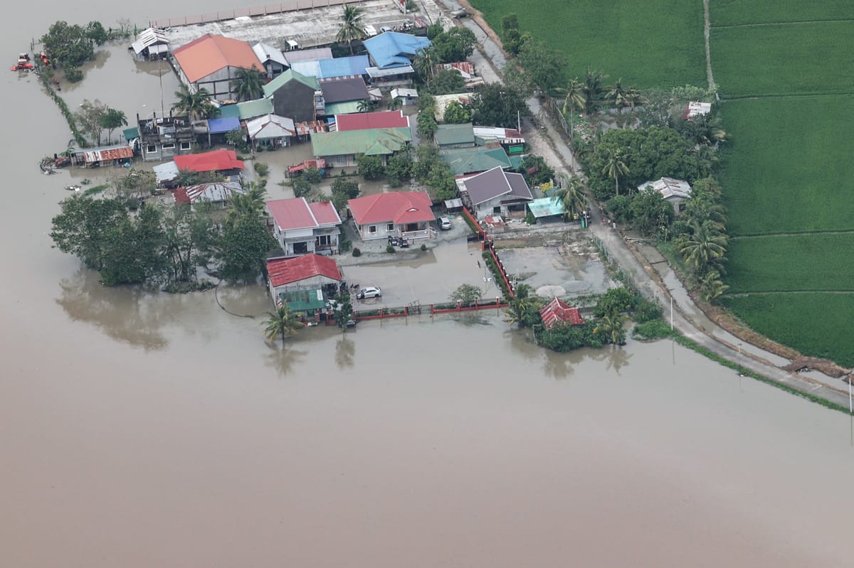
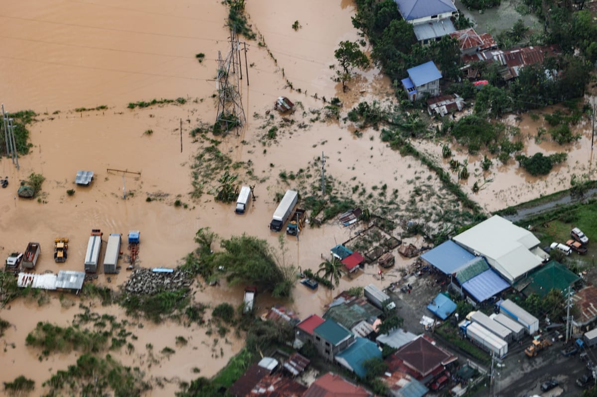
Typhoon Karding Updates from RINJ Women in the Philippines. Malacañang photo.

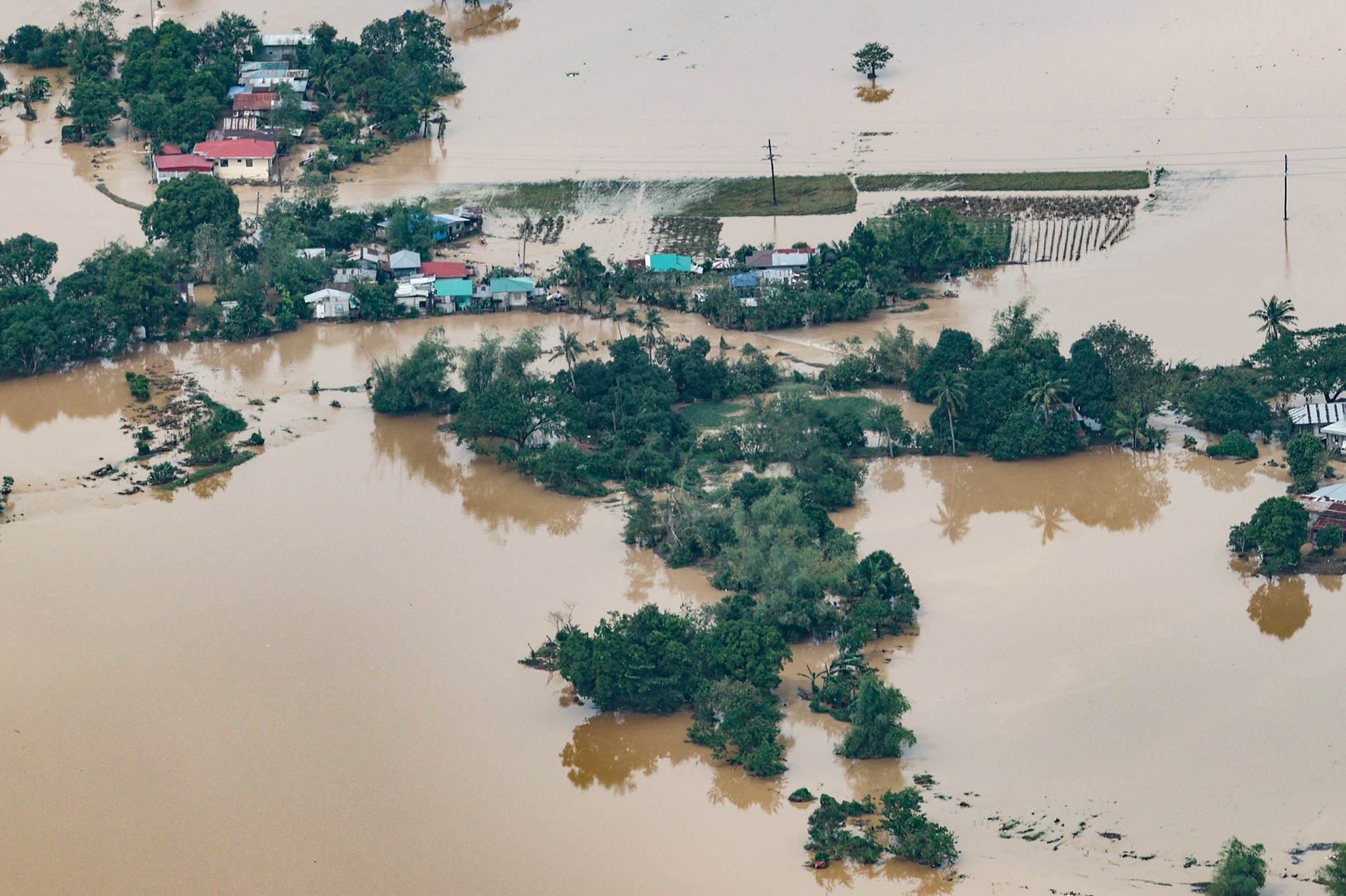
Typhoon Karding Updates from RINJ Women in the Philippines
Philippine homes and lives are left in tatters. Roofs in Polillo Islands are destroyed, many people are left homeless. Photo Credit: Quezon Province. Art/Cropping/Enhancement: Rosa Yamamoto FPMag
Typhoon Karding Update 2022-09-26 – 12:00 noon local (GMT + 8 Beijing Time)
The Philippines state news agency says President Ferdinand “Bongbong” Marcos Jr. on Monday directed the Department of Energy (DOE) to deploy more generators with fuel to areas in Nueva Ecija and Aurora that have limited power supply in the aftermath of Super Typhoon Karding.
In a situation briefing with top government officials at the National Disaster Risk Reduction and Management Council (NDRRMC) headquarters in Quezon City, DOE Secretary Raphael Lotilla bared that aside from Nueva Ecija and Aurora, other provinces facing power supply problems are Tarlac, Zambales, Pampanga, and Quezon. Lotilla said although main generation plants were spared from the typhoon, several areas remain partially affected by power supply issues.
Permanent evacuation centers on the table.
Department of Social Welfare and Development (DSWD) Secretary Erwin Tulfo, in the same briefing, suggested putting up permanent evacuation centers that are separate from schools.
“We really need to have an evacuation center in every municipality especially in every flood-prone area,” Mr. Tulfo said.
President Marcos recognized Tulfo’s proposal as a “good point”. At the president’s request, Secretary Tukfo will conduct a “quick study” on how long it takes for displaced individuals to return to their homes after they have been partially or completely damaged from rains and winds caused by typhoons.
Power coming back in some areas.
Most Filipinos in central Luzon awakened Monday without power, and many without roofs. Humanitarian workers have been on the go all night long. Reports so far in central Luzon suggest only minor injuries with some chronic illness exacerbations. There are reported deaths in the northeast of Qezon province, but it is not confirmed they were storm related or exacerbated existing cases.
Communications are sparse at this time so much more will be learned as the day passes and as the weakening Karding typhoon leaves the Philippines area of responsibility.

Malacañang photo. Ferdinand Marcos, late Sunday.
Shrouded in protective plexiglass, Philippines President Ferdinand Marcos (a.k.a. Bong Bong Marcos) gives orders for various departments relevant to the government response to Super Typhoon Karding which has now waned to the point of being a tropical storm in most areas of the Philippines as the eye of Karding (Noru) heads across the South China Sea headed for Vietnam. Philippines meteorological experts say the storm is likely to revitalize at landfall on the mainland.
According to official briefs, a “signal No. 1 warning” remains in effect over provinces, La Union, most of Pangasinan, the southern portion of Benguet (Sablan, La Trinidad, Itogon, Baguio City, Tuba, Kapangan, Tublay), most of Zambales, the northern portion of Bataan (Bagac, City of Balanga, Abucay, Samal, Morong, Orani, Hermosa, Dinalupihan), Tarlac, Pampanga, and the western portion of Nueva Ecija (Cabiao, San Isidro, Jaen, San Antonio, Lupao, Science City of Muñoz, Santo Domingo, Talavera, Aliaga, Zaragoza, Cuyapo, Talugtug, Nampicuan, Guimba, Licab, and Quezon.”
Strong winds to nearly gale strength winds have still been reported and may still be experienced in any of these areas.
One hour ago, at approximately 9:00 a.m. local time, “Karding” was spotted 190 kilometers west of Dagupan City, Pangasinan. It packs maximum sustained winds of 140 kms. per hour near the center and gustiness of up to 170 km/hr. Previously, gusts had been reported nearly 275 km/hr. hence the storm has subsided significantly, especially as it passed mountainous regions of the Philippines.
Farmers in the rich-soil agricultural flatland area of central Luzon are just now assessing the damage to the ‘fall’ (tropical) rice and corn crops which were seeded three weeks ago say farmers in the region, reporting their thoughts and data on social media via smartphone.
The typhoon is forecast to exit the Philippine Area of Responsibility in the West Philippines Sea on Monday night.

Ordered to the scene by President Ferdinand Marcos, Armed Forces of the Philippines with bare hands and assault weapons deal with coconut trees for Quezon municipality photographer. Photo Credit: Quezon Province. Art/Cropping/Enhancement: Rosa Yamamoto FPMag

In a curious display of irrelevance, Armed Forces of the Philippines with bare hands and assault weapons deal with fallen trees after department of works of Quezon Province saw off branches. Photo Credit: Official Quezon Province photo. Art/Cropping/Enhancement: Rosa Yamamoto FPMag
Warnings of “high” to “very high” risk of storm surges in coastal areas of Luzon Island were realized.
Video shows Polillo Islands in Quezon province at dusk, around 5:30 p.m. Sunday.. Official meteorological reports say winds have reached 190km per hour but local weather metrics report near 250 km/hr.
“We just used steel cables and tarpaulins to cover patient room windows as protection against blowing objects flying through the air, in our clinic in the mountains of Benguet, which says that even though its early we are looking at 100km/hr. winds already according to the wind meter spinning like crazy,” reports Karinna Angeles at 10:50PM (GMT +8 Beijing Time). We are 20 km from the shores of the South China Sea,” she added.
The internet is very slow and often off in central Luzon. Power is still available in many areas.

The Philippine Atmospheric, Geophysical and Astronomical Services Administration (PAGASA) officials have warned that this typhoon, now a super-typhoon, poses an extreme threat to life and property.
Typhoon Noru is also known here in the Philippines as Super Typhoon KardingPH. Noru reached super typhoon status quickly to the west of the Philippines during an explosive escalation that scientists at PAGASA say was unprecedented.
Signal 5 Warnings have been lifted —for more visit PAGASA HERE
| Meteorological Condition |
|
| Impact of the Wind |
|
| Precautionary Measures |
|
| What To Do |
|
Source: Philippine Atmospheric, Geophysical and Astronomical Services Administration (PAGASA)
Video by @FILIPINA


